Datei:BC-relief.png
Zur Navigation springen
Zur Suche springen

Größe dieser Vorschau: 585 × 599 Pixel. Weitere Auflösungen: 234 × 240 Pixel | 469 × 480 Pixel | 659 × 675 Pixel
Originaldatei (659 × 675 Pixel, Dateigröße: 605 KB, MIME-Typ: image/png)
![]()
Diese Datei und die Informationen unter dem roten Trennstrich werden aus dem zentralen Medienarchiv Wikimedia Commons eingebunden.
![]()
Beschreibung
| Beschreibung |
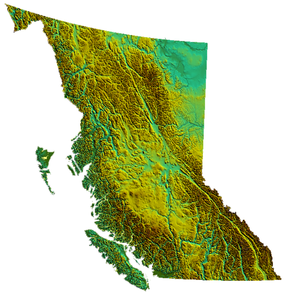
relief of British Columbia, Canada produced from USGS data |
| Datum | 31. März 2006 (Original-Hochladedatum) |
| Quelle | Die Autorenschaft wurde nicht in einer maschinell lesbaren Form angegeben. Es wird angenommen, dass es sich um ein eigenes Werk handelt (basierend auf den Rechteinhaber-Angaben). |
| Urheber | Die Autorenschaft wurde nicht in einer maschinell lesbaren Form angegeben. Es wird Qyd als Autor angenommen (basierend auf den Rechteinhaber-Angaben). |
Lizenz
| Ich, der Urheberrechtsinhaber dieses Werkes, veröffentliche es als gemeinfrei. Dies gilt weltweit. In manchen Staaten könnte dies rechtlich nicht möglich sein. Sofern dies der Fall ist: Ich gewähre jedem das bedingungslose Recht, dieses Werk für jedweden Zweck zu nutzen, es sei denn, Bedingungen sind gesetzlich erforderlich. |
Dateiversionen
Klicke auf einen Zeitpunkt, um diese Version zu laden.
| Version vom | Vorschaubild | Maße | Benutzer | Kommentar | |
|---|---|---|---|---|---|
| aktuell | 03:39, 4. Nov. 2006 | | 659 × 675 (605 KB) | Qyd | transparent background |
| 04:01, 31. Mär. 2006 |  | 659 × 675 (536 KB) | Qyd | relief of British Columbia, Canada |
Dateiverwendung
Die folgende Seite verwendet diese Datei:
Globale Dateiverwendung
Die nachfolgenden anderen Wikis verwenden diese Datei:
- Verwendung auf as.wikipedia.org
- Verwendung auf bcl.wikipedia.org
- Verwendung auf en.wikipedia.org
- Coombs, British Columbia
- Della Falls
- Regional District of Kootenay Boundary
- Eagle Pass (British Columbia)
- Cameron Bar Indian Reserve No. 13
- Mount McGuire (Alberta)
- Mount King Edward
- Flores Island (British Columbia)
- Ball Range
- 105 Mile Post Indian Reserve No. 2
- Madeira Park
- Queen Charlotte Sound (Canada)
- Nootka Island
- Beatrice Peak
- Isabelle Peak
- Duke Point, British Columbia
- Haiduk Peak
- Kinney Lake
- Spanish Bonk
- Mount Cornwell (Canada)
- Laidlaw, British Columbia
- Pearse Island
- Portland Canal
- President Range
- Regional District of Central Kootenay
- Regional District of Bulkley-Nechako
- Cowichan Valley
- Saltair, British Columbia
- Mount Macdonald
- Basque, British Columbia
- Oweekeno
- Clark Range (Canada)
- Kaien Island
- Mount Field (British Columbia)
- Beaverfoot Range
- Halfmoon Bay, British Columbia
- Atlin Lake
- Williston Lake
- Columbia Valley
- Lake Revelstoke
- Moyie Lake
- Wood Lake (British Columbia)
- Baynes Sound
- Kokanee Lake
- Kinbasket Lake
- Wasa Lake
- Wilmer, British Columbia
- Inga Lake
Weitere globale Verwendungen dieser Datei anschauen.